Access Comprehensive Land Data With MapyMate Handheld GPS Device
MapyMate transforms complex land measurements into simple digital readings, delivering professional accuracy for farmers, surveyors, and property managers in an intuitive handheld device.
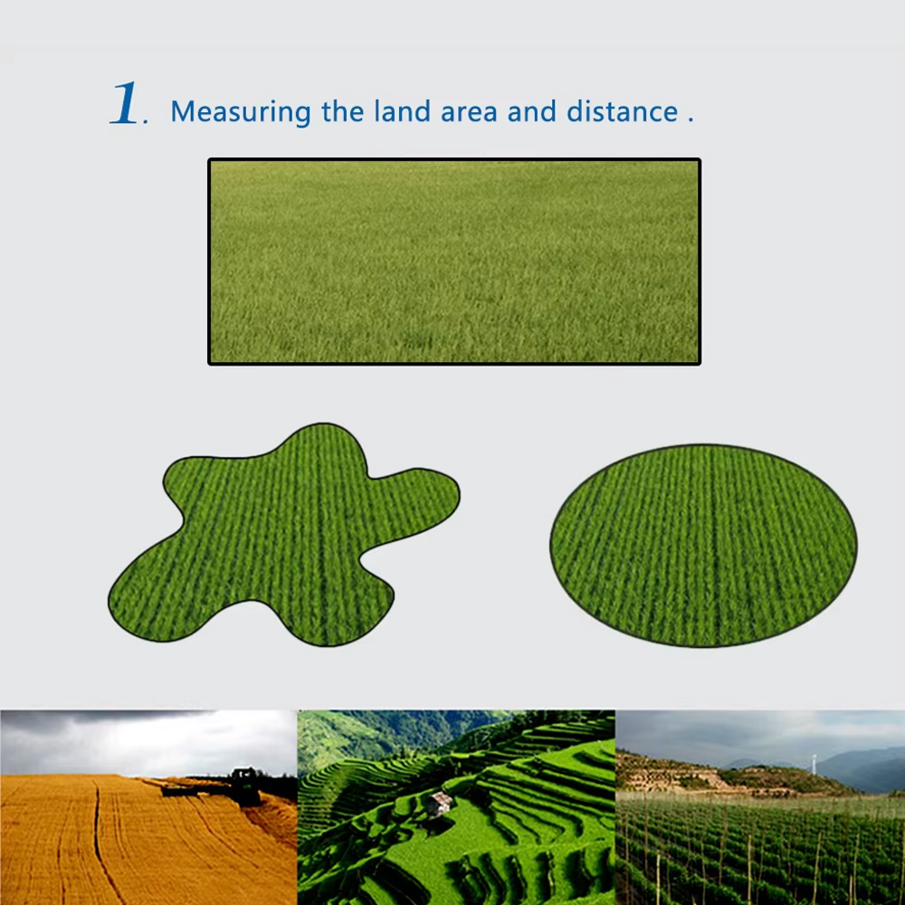
Achieve Professional-Grade Measurements On Any Landscape With MapyMate
Maintaining Clear Communication While Driving?
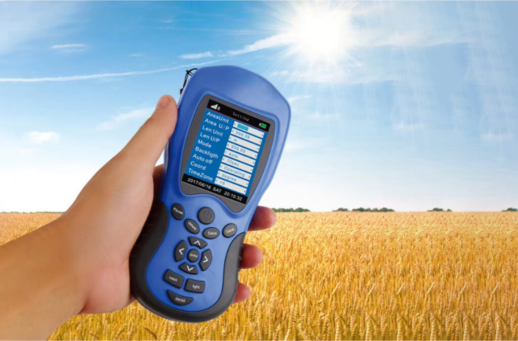
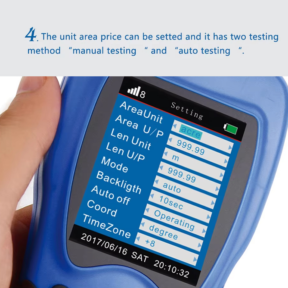
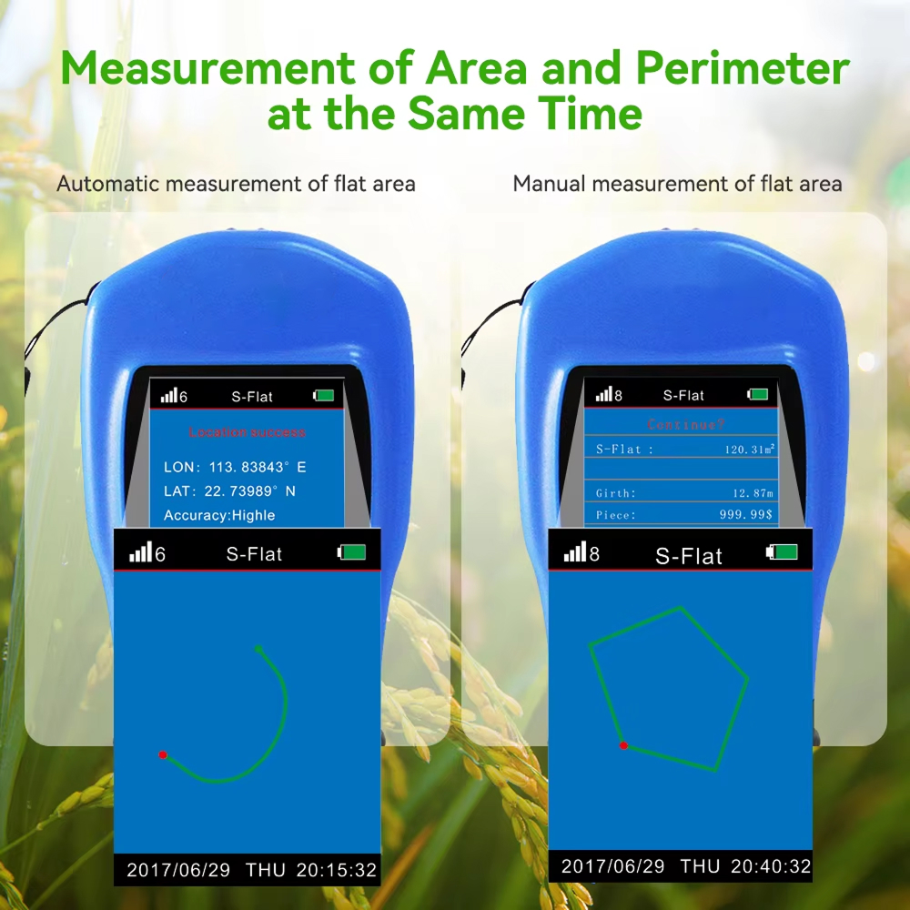
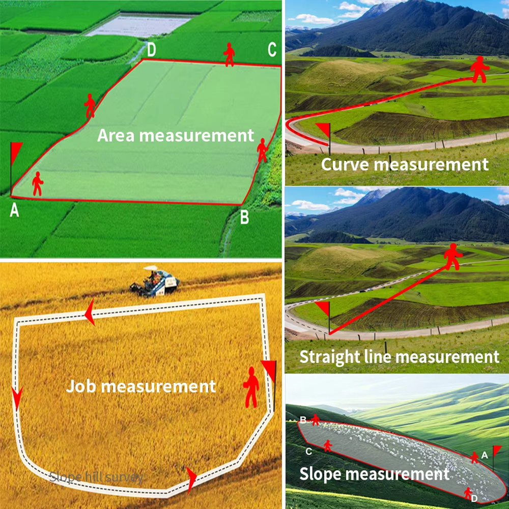
MapyMate delivers professional-grade accuracy within 0.5-3 meters, even on challenging terrain like mountains and slopes. The advanced GPS technology automatically calculates both area and perimeter simultaneously, eliminating hours of manual calculations and potential human error in your important property assessments.
Need To Document Multiple Properties Quickly?
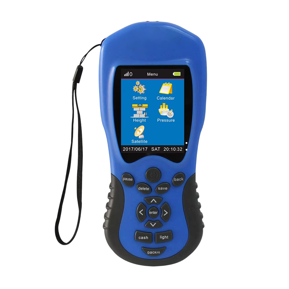
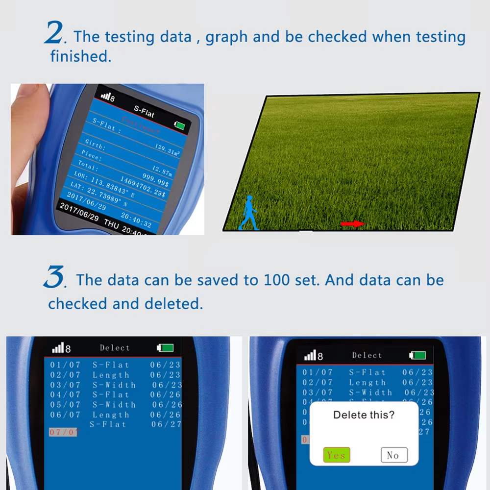
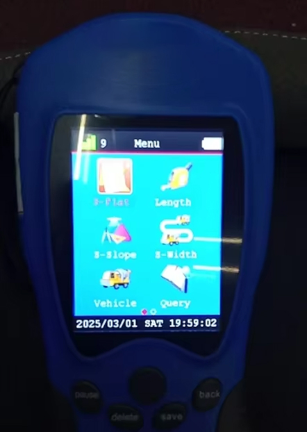
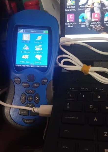
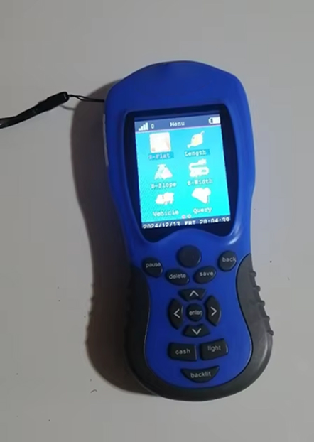
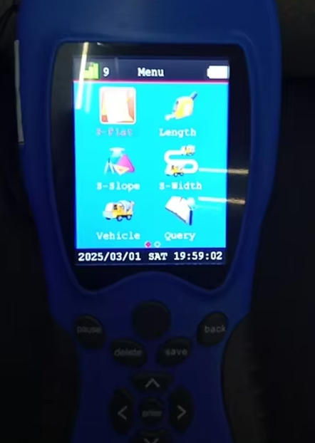
With multiple measurement modes including automatic, manual, and constant width, MapyMate adapts to your specific surveying needs. The device stores up to 100 historical measurements with visual graph tracks, allowing you to compare properties, create documentation, and access critical data whenever you need it.
Worried About All-Day Field Performance?
MapyMate’s dual 2000mAh lithium batteries provide 8-10 hours of continuous operation per battery, ensuring all-day performance even in remote locations. The quick 4-5 hour recharge time means you’ll never miss crucial measurement opportunities, while the included carrying case protects your investment in any working environment.
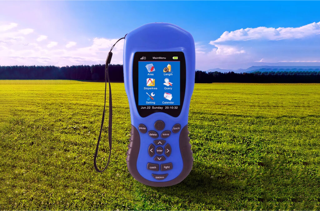
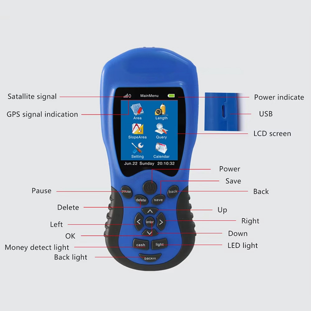
Navigate Challenging Terrains With MapyMate Handheld GPS Device
4.8 rating based on total orders
Access Stored Measurements Anytime
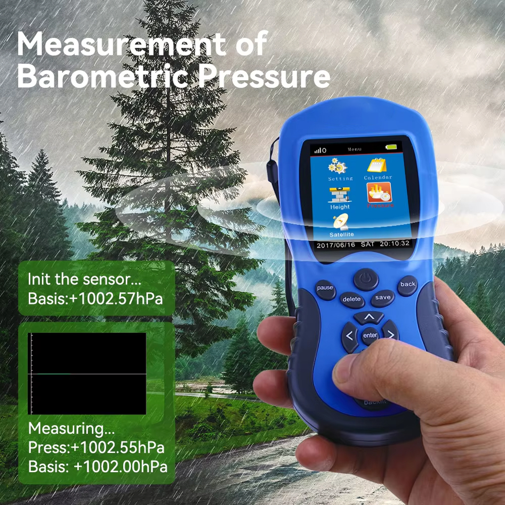
Beyond basic measurements, MapyMate integrates practical tools including night vision lighting for low-light conditions, backlight adjustment for optimal visibility, and even a banknote inspection feature.
“Working in remote areas, the extended battery life is crucial. With two batteries included, I can work multiple days without needing to recharge, which has been a game-changer for my rural work.”
Transform Any Land Survey Into Precise Digital Measurements Today
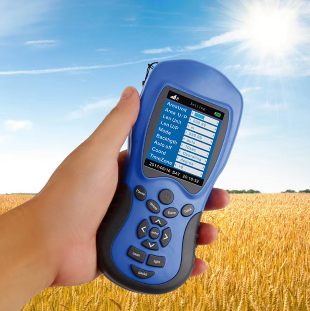
MAPYMATE ALL FEATURES YOU CAN EXPECT:
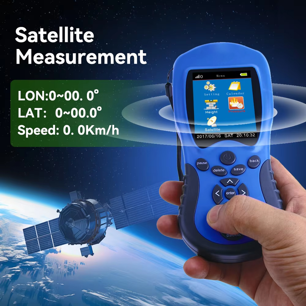
SATELLITE PRECISION
MapyMate connects to multiple satellites simultaneously, ensuring measurements accurate even on challenging terrain where traditional methods fail or require extensive additional calculations.
VISUAL TRACKING
See exactly what you’re measuring with real-time graph tracking that displays property boundaries as you walk them, eliminating guesswork and providing visual confirmation of measurement accuracy.
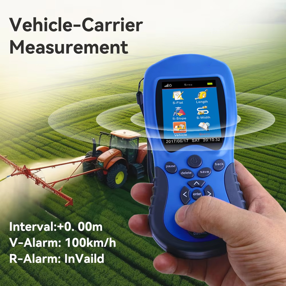
MULTIPLE MODES
Switch between automatic, manual, constant width, and vehicle-mounted modes to adapt to different measurement scenarios, from small gardens to vast agricultural fields.
INSTANT CALCULATIONS
Beyond simple measurements, automatically calculate price estimates based on your custom unit pricing, enabling immediate cost assessments for contractors, farmers, or land managers.
EXTENDED BATTERY
Dual 2000mAh lithium batteries deliver a full day of operation, eliminating the frustration of interrupted work and ensuring reliability in remote locations where charging isn’t available.
COMPLETE PACKAGE
Everything you need comes included: the device, dual batteries, charging adapter, cable, instruction manual, and protective carrying case for immediate professional use right out of the box.
IMAGE GALLERY
What's Included in Your Package?
Handheld GPS Device
Charging Adapter
Charging Cable
User Manual
24/7 Customer Support
We understand the value of your time. That’s why our team is trained to respond promptly and efficiently, ensuring your queries and issues are addressed without unnecessary delays.
For optimal results, use in areas with clear sky visibility, though minor obstructions won’t significantly impact accuracy.
SAVE MULTIPLE MEASUREMENT DATA EFFORTLESSLY WITH MAPYMATE
Loved by Thousands of Satisfied Users
Brooks R.
Despite having no technical background, I mastered MapyMate within minutes. Now I use it for my landscaping business to provide accurate quotes that have significantly improved my closing rate with potential clients.
VERIFIED BUYER
James D.
We previously used equipment costing five times more but needed technical training. MapyMate delivers comparable accuracy with much simpler operation, allowing us to equip more team members at a fraction of the cost.
VERIFIED BUYER
Steiner M.
For preliminary site assessments, MapyMate provides the accurate measurements we need before deploying more specialized equipment. It’s become an essential tool in our initial consultation process.